Hazard mitigation is about creating a more resilient and sustainable community by reducing or eliminating injury to citizens and damages to structures and allowing continuity of critical society functions in the event of a natural or human-caused disaster.
When a major natural event strikes, it is often described as a natural disaster. Natural disasters and their aftermath have long affected humans and the built environment. Pre-disaster hazard mitigation is about preventing or minimizing the physical, financial, and human impacts of natural disasters.
The region’s planners and emergency management professionals have been working to identify the region’s likely hazards, assess the impact of them and determine what can be done to reduce or eliminate the risk they pose to people and property and compile a plan for the New River Valley to implement policies, programs and projects that will build its resilience to disasters.
Your contribution is valuable to the process, so please continue to participate in the process in the ways that best fit your availability. Input from all participants will contribute to the success of the planning process and build partnerships for future success. You’ll find information from our working groups, surveys, and requests for feedback as well as the draft plan and any other upcoming involvement opportunities on this page.
FINAL PLAN NOW AVAILABLE

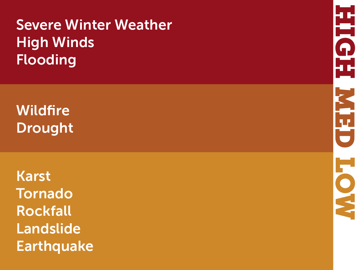
The region’s risks (most likely to happen and/or most impactful) have been ranked and strategies to reduce impacts and loss in the event of a disaster have been identified. The final plan is available for review with the high-ranked risks and the region’s vulnerable assets are analyzed and ways to reduce an event’s impact on those assets are outlined. Comments can still be made on the plan; however, the 2025 planning process is complete and any comments received will be retained for consideration in the next plan update.
What’s in this plan?
You’ll find an overview of the project and mitigation planning in the first chapter.
Chapter 2 provides an overview of the current landscape in the region (population, housing, existing facilities and anticipated growth).
Chapter 3 describes the process used in developing the plan along with more information about who participated.
Chapter 4 (the largest chapter in the plan) dives into naming each hazard, its history, assessing its likelihood of impacting our area and to what extent, and a summary of goals and objectives for mitigation.
A comprehensive listing of mitigation strategies is provided in Chapter 5 for each participating locality and strategies for regional collaboration as well. An assessment of local resources is summarized to provide a reference for how and where a locality could implement mitigation activities with existing resources.
In Chapter 6, a summary of each locality’s risk, past and current mitigation, and strategies for future implementation are listed.
Chapter 7 points the way forward in implementing these mitigation activities and keeping track of progress.
The document is provided in chapters for ease of downloading and reading. Each link below will take you to a PDF of the draft chapter. You can submit any comments you have in the comment section below. These will be addressed in future plan updates.
Chapter 4. Hazard Identification and Risk Assessment (HIRA)
Chapter 5. Mitigation Strategy
Chapter 6. Community Summaries
Appendix 1. Meeting Documentation
Appendix 2. Adoption Resolutions


